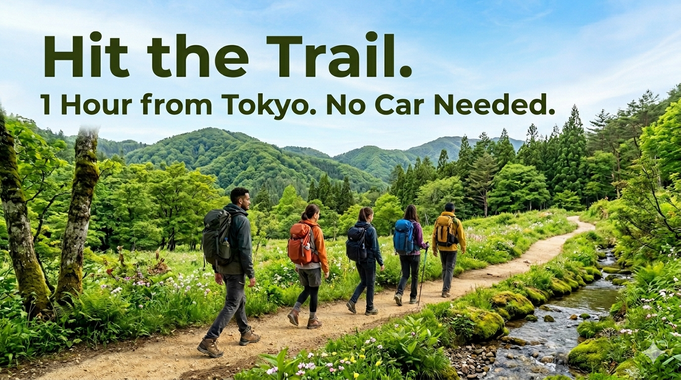
Tokyo to the mountains in under an hour. No car. No guide. No excuses. Japan’s trail system is one of the best-kept secrets in travel — and this guide is how you use it.
When most people plan a trip to Japan, the itinerary looks something like this: Tokyo, Kyoto, Kit Kats in seventeen flavors, and go home. It’s a great trip. But there’s an entire dimension most visitors miss — right there, beyond the train window.
Hiking.
For us Japanese, nature has never been just scenery. Every cedar, every river stone, every misty ridge has a spirit living in it. Stepping onto a mountain trail can feel less like recreation and more like entering sacred ground. When I hike here, what stops me isn’t exhaustion — it’s something closer to gratitude. I want you to feel even a little of that.
And you can. Dense forests, ancient shrines on ridgelines, Mount Fuji above the clouds, warm soba at 855 meters — all accessible from Tokyo by train. Often in under an hour. Breakfast in the city, lunch on a summit, ramen by dinner.
That’s Japan.
- First: Why Japanese Hiking Culture Is Different
- Option A: Day-Trip Trails — Back in Tokyo for Dinner
- Option B: Stay the Night — The Shukubo Experience
- What to Eat on the Trail: Japan’s Hiking Snack Culture
- Japan’s Secret Weapon: Getting There Without a Car
- Quick Reference: Trail Comparison
- A Few Last Things Before You Go
First: Why Japanese Hiking Culture Is Different
Before you hit the trails, it helps to know a few things that guidebooks often skip. Japanese hiking culture has its own rhythms, etiquette, and delightful quirks that are worth understanding.
The Mountain Greeting: Konnichiwa
On Japanese trails, hikers greet each other — every single one. You’ll get a gentle “konnichiwa” from almost everyone you pass, and the expected response is the same back. It sounds small, but after an hour of it, something shifts. You feel genuinely welcomed into the mountain. It’s one of those tiny cultural details that makes Japanese hiking feel warm in a way that’s hard to describe.
The Teahouse System (Chaya )
Many popular Japanese mountains have small teahouses — chaya — at or near the summit. These aren’t elaborate restaurants; they’re often just a wooden shack with a stove, a cheerful owner, and a menu of noodles, oden, and hot drinks. But the experience of sitting down, pulling off your pack, and eating a bowl of warm mushroom soup with a view of the Kanto plain is something you will remember for a long time. Some mountains have two or three competing teahouses, which gives you an excellent excuse to “sample” multiple options.
Trail Signage — Better Than You Think
Popular trails near Tokyo are very well signposted, often with distance and estimated time to the next landmark. Many signs now include English or romaji. Apps like YAMAP (yamap.com) are the gold standard for Japanese trail navigation and work offline — essential if you’re heading off the beaten path.
Mountain Safety Registration (Tozan Todoke )
For anything beyond a casual stroll, Japanese hiking culture encourages filling out a tozan todoke — a mountain safety registration form. Many trailheads have paper forms in a box. It feels bureaucratic until you realize it exists so that if something goes wrong, someone knows where to look for you. You can also submit online via the official mountain registration system (mt-tozan.mlit.go.jp).
The “No Litter” Culture
Japanese mountains are remarkably clean. There are rarely rubbish bins on the trail — hikers carry out everything they bring in. Pack a small zip-lock bag and follow suit. The other hikers will notice and appreciate it.
Option A: Day-Trip Trails — Back in Tokyo for Dinner
You’ve got a free day. The weather forecast is good. You want mountains, not museums. Here are two trails that deliver maximum reward for minimum logistics.
🐴 Trail 1: Jinba-san (Mt. Jinba) — The Panoramic Summit
Distance from Shinjuku: ~60 min by JR Chuo Line
Summit elevation: 855 m
Round-trip hiking time: approx. 4 hours
Difficulty: Beginner to Moderate
I’ll be honest — I’m biased. I live near Mt. Jinba, so I know this mountain better than most. And that’s exactly why I can tell you with confidence: this place is something special.
Forget Takao-san. Yes, Mount Takao is lovely, but on a sunny weekend, it can feel like a theme park with better air quality. Jinba-san is the answer for those who want the real thing without the shoulder-to-shoulder crowds.
From the summit, you’ve got a shot at a stunning view of Mt. Fuji — but your odds drop in summer and in the afternoon. Go early. That’s the insider tip. The rest? Well, that’s up to luck. 🤞
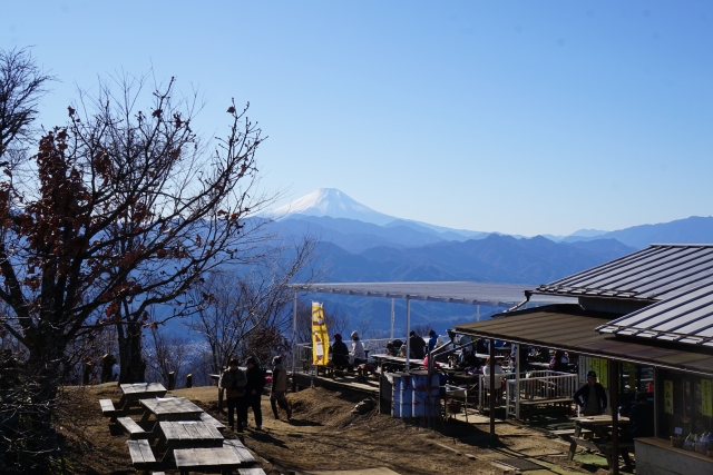
The summit of Jinba-san is one of the most satisfying in the Kanto region: a wide, grassy plateau with a full 360-degree panorama. On a clear day, you can see Mount Fuji, the Sagami Bay coastline, and even Tokyo Skytree shimmering in the distance. And right in the middle of all this stands the mountain’s mascot — an iconic white horse statue that has become one of the most photographed spots on the Okutama–Tanzawa hiking belt. It’s simultaneously slightly absurd and completely charming. Very Japan.
The approach from the Fujino side (via Fujino Station on the JR Chuo Line) is less crowded than the Takao approach and gives you a lovely walk through quiet mountain villages and cedar woodland before the trail begins in earnest. The Ichi-no-one ridge trail is the most beginner-friendly route up. At the summit, three competing chaya teahouses await — try the local yuzu-flavored dishes from the Fujino valley below.
After descending, the trail connects onward toward Takao-san if you’re feeling ambitious — making this one of the finest ridge walks in the Tokyo vicinity. But for a relaxed day hike, reach the summit by noon, linger over lunch at a teahouse, and head back to Fujino or continue to Sagamiko Station.
🚃 Getting There — Step by Step
From Shinjuku Station:
JR Chuo Line (Special Rapid or Rapid) → Fujino Station (~55–60 min, ~¥770)
※One important thing to know: once you pass Takao Station, trains on the JR Chuo Main Line suddenly become much less frequent. Check the timetable in advance — missing a train out here can easily add an extra 30–60 minutes to your journey.
From Fujino Station to the trailhead:
- By bus: Kanagawa Chuo Bus toward Jinba-Tozan-guchi — about 5 min. Buses run infrequently, so check the timetable before you leave.
- On foot: About 30 min along a quiet village road — a pleasant option on a dry day.
Return: Retrace to Fujino Station, or continue the ridge to Takao-san and exit at Takaosanguchi Station (JR Sagamiko Line).
📎 Fujino Tourism Association — Jinba-san Hiking Info
📎 Jinba-san Official Trail Guide (jinba.travel)
⛩️ Trail 2: Kamakura — Ten’en Hiking Course
Distance from Tokyo Station: ~55 min by JR Yokosuka Line
Highest point: 159 m (Ohira-yama)
Full course length: approx. 5.5 km
Difficulty: Easy to Moderate
“I love the vibe of Kyoto, but I actually want to walk around.” If that sentence resonates with you, Kamakura is your answer — and the Ten’en Hiking Course, also called the “Kamakura Alps” (yes, really), is how you see it properly.
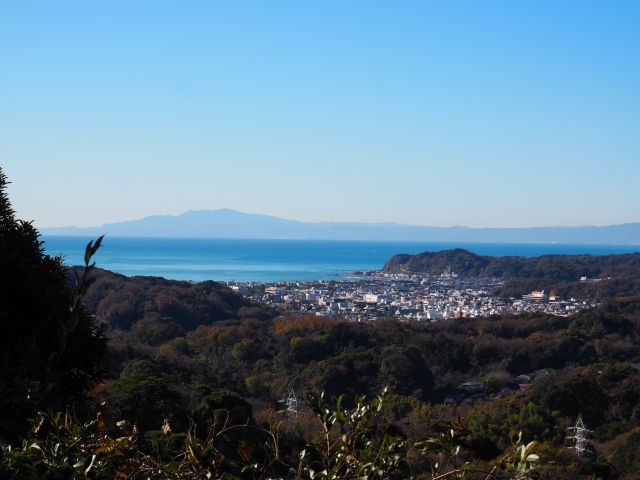
The trail runs about 5.5 km through the forested ridgeline north of Kamakura, connecting the great Zen temple of Kencho-ji to the flower temple of Zuisen-ji. What makes it unique is the way history seeps out of the landscape: ancient stone yagura (carved cliff tombs), mossy Buddhist figures, medieval castle remnants, and glimpses of the ocean between the trees. This is a trail that doesn’t let you forget where you are.
Start at Kita-Kamakura Station, walk through the grounds of Kencho-ji (admission: ¥500 — the trail begins inside the temple itself), and emerge about two hours later near Zuisen-ji on the other side of the ridge. From there, it’s a short bus or walk to Kamakura Station, where an excellent restaurant scene awaits.
🚃 Getting There — Step by Step
From Tokyo Station:
JR Yokosuka Line → Kita-Kamakura Station (~55 min, ~¥940)
From Kita-Kamakura Station to the trailhead:
Walk south along the main road for about 15 min → Kencho-ji temple (entrance fee ¥500). The hiking trail begins inside the temple grounds.
Where the trail ends:
The course finishes near Zuisen-ji temple. From there, take a local bus (~10 min) or taxi to Kamakura Station for trains back to Tokyo.
📎 Ten’en Hiking Course — Kamakura Tourism Official Guide
⚠️ Good to Know
The trail passes through Kencho-ji temple, which charges a ¥500 entry fee. Wear proper shoes — the path includes rocky sections, steep staircases, and rope-assisted scrambles. After heavy rain, the course can be quite slippery.
Overnight option: Kamakura has excellent accommodation ranging from traditional ryokan to boutique guesthouses. Hike in the morning, spend the afternoon at Hase-dera temple or the Komachi shopping street, and catch the sunset over the ocean from Inamuragasaki Point. It’s an effortlessly beautiful 24 hours.
Option B: Stay the Night — The Shukubo Experience
If a day hike is a date, an overnight mountain stay is a relationship. Japan’s shukubo (宿坊) tradition — lodging in temple or shrine guesthouses — is one of the most distinctive travel experiences available in the country, and one of the most overlooked by visitors who don’t know it exists.
🌿 Trail 3: Mt. Mitake + Rock Garden — Sacred Forest in Tokyo Prefecture
Distance from Shinjuku: ~75 min by JR Chuo + Ome Lines
Summit elevation: 929 m
Difficulty: Easy to Moderate (cable car available)
Shrine history: over 2,000 years
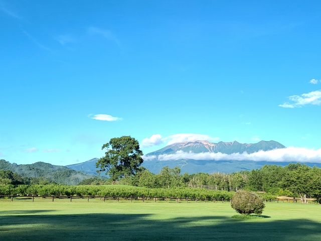
Mitake-san is not just a mountain. It’s a mountain village, suspended in the forest at nearly 900 meters, accessible by cable car, with a functioning Shinto shrine, a cluster of ancient shukubo guesthouses, resident priests, and trails leading through some of the most spectacular moss-covered forest in the Kanto region.
Musashi-Mitake Shrine has a history stretching back over 2,000 years. The mountain-top settlement that surrounds it has been serving pilgrims and wanderers for most of that time. The shukubo here are not austere meditation retreats — they’re warm, welcoming, full-board guesthouses where you eat multi-course traditional Japanese meals and wake up to the sound of shrine bells and birdsong.
Below the summit, the Rock Garden trail is one of the most magical walks in greater Tokyo: a 1.5-hour loop through a narrow gorge where water trickles over moss-covered boulders, enormous Japanese cedar trees arch overhead, and the light filters down in long green columns. It is, genuinely, the kind of place where you start walking slower because you don’t want it to end.
Some shukubo also offer unique experiences like takigyō — waterfall meditation practice — or guided night walks to spot flying squirrels (musasabi) gliding between the trees in the dark. These are not experiences you’ll stumble upon anywhere else in the world.
🚃 Getting There
From Shinjuku: JR Chuo Line → Tachikawa, change to JR Ome Line → Mitake Station (approx. 75 min total). Bus from Mitake Station to the cable car, then ride up to Mitake-san-ue Station and walk ~15 min to the shrine village.
📎 Mitake-san Commerce Association — Official Site (mitakesan.com)
📎 Shukubo Mitake Sanso — Guesthouse Official Site
📎 Shukubo Nobori — Traditional Guesthouse Official Site
💡 Booking Tip
Shukubo accommodation books up quickly on weekends, especially in autumn (October–November) when the foliage turns. Book at least 2–3 weeks ahead. Most guesthouses can handle English enquiries by email, and some appear on major Japanese hotel booking sites with English interfaces.
What to Eat on the Trail: Japan’s Hiking Snack Culture
This section may be the most important thing you read today. Japanese hikers take their trail food seriously, and you should too. The combination of excellent convenience store infrastructure, health-conscious snack culture, and the uniquely Japanese practice of eating instant noodles on mountaintops has produced one of the world’s finest portable food scenes.
🍠 Hoshi-imo (干し芋) — Dried Sweet Potato
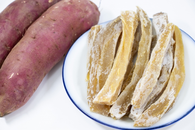
Chewy, naturally sweet, and surprisingly filling. No added sugar, loads of fiber. The kind of snack that makes you feel virtuous while also being genuinely delicious. Find it at any convenience store or supermarket. It’s the Japanese hiker’s answer to the energy bar — and considerably tastier.
🍜 Cup Noodle on the Summit
This sounds mundane until you’ve actually done it. Eating Cup Noodle at a mountain summit with a view of Mount Fuji is a defining Japanese experience. Many teahouses sell hot water for ¥100–200. Bring the mini-size (under 300 calories, pocket-sized) or a lightweight camping stove if you want the full romantic version. Fair warning: you will want to do this on every future hike, everywhere in the world, and it will never be as good.
💊 Amino Vital— Amino Acid Supplement
Japanese hikers swear by these little powder sticks for muscle recovery. Available at any drug store (doragu sutoa). Mix with water, feel vaguely scientific about your trail prep. They genuinely help with next-day soreness — and at around ¥150 a stick, they’re considerably cheaper than the equivalent Western sports supplement.
🍬 Ramune Candy — The Fast-Energy Cheat Code
When your legs start arguing with you on the final climb, pop a few Ramune candies — they’re essentially pressed glucose tablets marketed as sweets. A beloved Japanese hiking trick. Costs about ¥100 and fits in any pocket. The grape flavor is the correct choice. This is not a debate.
🍱 Onigiri — Rice Ball
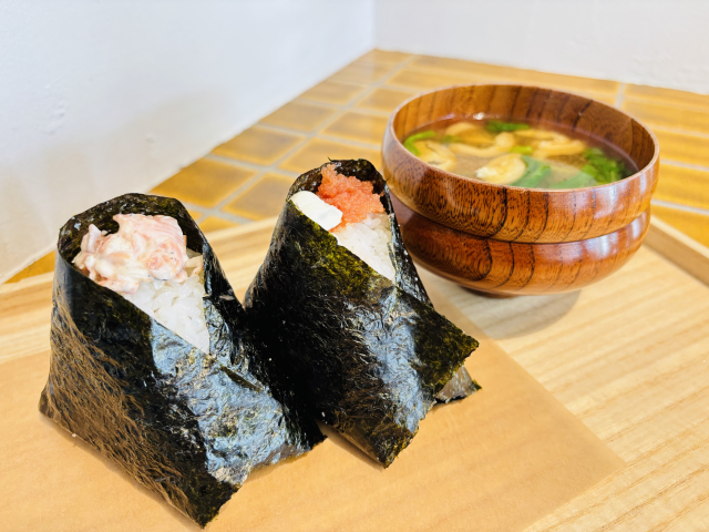
The perfect trail food: compact, satisfying, cheap, and available in 40+ varieties at any convenience store. Tuna mayo, salmon, kombu seaweed, pickled plum — you’ll develop strong opinions by day two. A classic two-onigiri lunch weighs less than 300g and costs under ¥300. Nothing beats this power-to-weight ratio.
🍫 Calorie Mate — Japan’s Energy Bar
Biscuit-like, nutritionally balanced, extremely packable. Far better than most Western alternatives and available everywhere. Also, look for SOYJOY bars at convenience stores. These are Japanese hiking staples for good reason. You can easily find it at convenience stores, supermarkets, and drugstores in Japan.
Japan’s Secret Weapon: Getting There Without a Car
Here’s something that visitors from car-dependent countries find almost unbelievable: in Japan, you can reach legitimate mountain trailheads entirely by public transport. Train, then bus, then walking — and you’re in the wilderness. No rental car, no designated driver, no parking anxiety.
In many parts of Australia, the American West, or rural Europe, a good hiking trail requires driving 45 minutes down a dirt road. In Japan, the same quality of trail is accessible from a station where trains run every 15 minutes. This is not a small thing. It means you can have a beer at the summit teahouse. It means you can hike without worrying about driving home tired. It means solo travelers and people who don’t drive can access exactly the same mountains as everyone else.
The key tool here is Google Maps, which now does an excellent job with Japanese bus schedules, or the Hyperdia app for train routing. Always check the last bus back from the trailhead area before you start — some rural bus routes run only a few times per day. A one-minute check before you leave the hotel can save a very uncomfortable afternoon.
📱 Essential Apps for Hiking in Japan
YAMAP — Japan’s best offline trail map app: yamap.com
Google Maps — excellent for transit routing including local buses
Weather — check mountain weather specifically; summit conditions differ significantly from valley forecasts
Mt. Tozan — submit your safety registration online: mt-tozan.mlit.go.jp
Quick Reference: Trail Comparison
| Trail | From Shinjuku | Best For | Overnight? | Difficulty |
|---|---|---|---|---|
| Jinba-san | ~60 min (JR Chuo Line) | Panoramas, quiet trails, teahouse lunch | Day trip | ⭐⭐☆☆☆ |
| Kamakura Alps | ~55 min (JR Yokosuka Line) | History + nature, temple start | Excellent option | ⭐⭐☆☆☆ |
| Mitake-san | ~75 min (JR Chuo + Ome) | Shukubo stay, moss forest, shrine culture | Highly recommended | ⭐⭐☆☆☆ |
A Few Last Things Before You Go
Dress in layers. Mountain weather in Japan changes quickly, especially in spring and autumn. A light rain jacket is non-negotiable — even on a sunny morning. The convenience store poncho (¥500 at any 7-Eleven) is a legitimate last resort, but real waterproofs are better.
Start early. Japanese hikers tend to hit the trails early, and the mountains are at their best before 10am — fewer people, better light, more wildlife. The bonus: you’ll be done before the midday heat in summer and safely off the mountain before darkness in winter.
Respect the trail community. Say konnichiwa. Pack out your rubbish. Yield to descending hikers on narrow paths. Don’t play music out loud. These small things are taken seriously, and following them earns you a genuine place in the mountain community — which is one of the nicest communities there is.
You don’t need special gear. A pair of decent sneakers (not sandals) is sufficient for all three trails in this guide. Trekking poles are appreciated on steep descents but not required. A 1.5L water bottle and a daypack complete the kit.
Japan’s mountains are not waiting to be discovered — they’ve been there for millennia, sustaining a culture of walking, reverence, and excellent noodles. They’re just waiting for more visitors to step off the tourist trail and onto the real one.
Written from Experience
I live in Fujino, Yamanashi — the gateway village to Jinba-san — which means these aren’t recommendations assembled from a laptop. These trails are my neighbours. On a good morning I can be on the ridge in under an hour from my front door. If you have questions about any of these routes or want advice on timing your trip, drop a comment below.


Share your thoughts